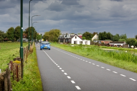
In the Netherlands, the predictability of roads is mainly executed by using markings that differ per road category. CROW has prepared guidelines on the essential features for recognisability of road infrastructure and these have now been included in the Manual for Road Design [21]. Table 1 shows the markings to be used. They have been implemented on most roads.
Making roads predictable ensures that road users always know what kind of road they are driving on, who they may encounter there (predictability) and how to behave. For the predictability of roads, it is important not only to distinguish between road categories, but also to have uniformity within road categories [22].
Public communication can improve the knowledge about the meaning of road markings, but in practice it appears that driving behaviour is mainly intuitively evoked by the design of the road [23] [24]. For more information, see the archived SWOV fact sheet Recognisable road design.
Recognisable road design ensures that road users know how to behave, but this does not imply that they actually do. To achieve this, it is important that correct behaviour is also provoked or enforced, for example by a credible speed limit, speed reducing measures or by making overtaking physically impossible. For more information on a credible speed limit, see for example [25] and SWOV fact sheet Speed and speed management.
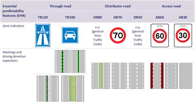
Table 1. Elaboration of essential predictability features [21]. Each road type has its own zone indication; the marking is elaborated per road type and can be applied in both urban and rural areas. The elaboration of physical driving direction separation for through-roads applies to both regional (SW100) and national through-roads (SW130). In accordance with the guidelines, a green centre marking can also be chosenn.